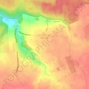
La Haye-de-Routot topographic map
Interactive map
Click on the map to display elevation.
About this map
Name: La Haye-de-Routot topographic map, elevation, terrain.
Average elevation: 120 m
Minimum elevation: 66 m
Maximum elevation: 142 m

Click on the map to display elevation.
Name: La Haye-de-Routot topographic map, elevation, terrain.
Average elevation: 120 m
Minimum elevation: 66 m
Maximum elevation: 142 m