
Thank you for supporting this site ❤️
Make a donation
Make a donation
Bezau topographic map
Click on the map to display elevation.
Thank you for supporting this site ❤️
Make a donation
Make a donation
About this map
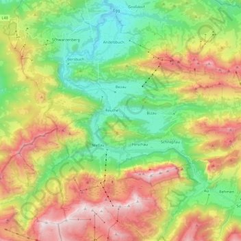
Name: Bezau topographic map, elevation, terrain.
Location: Bezau, Bezirk Bregenz, Vorarlberg, 6870, Austria (47.33004 9.87810 47.39937 10.09299)
Average elevation: 1,142 m
Minimum elevation: 529 m
Maximum elevation: 2,050 m
Thank you for supporting this site ❤️
Make a donation
Make a donation