
Marchigüe topographic map
Interactive map
Click on the map to display elevation.
About this map
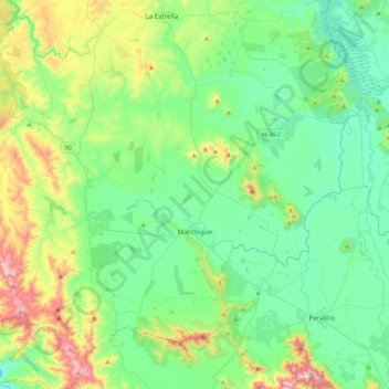
Name: Marchigüe topographic map, elevation, terrain.
Average elevation: 207 m
Minimum elevation: 64 m
Maximum elevation: 644 m
Other topographic maps
Click on a map to view its topography, its elevation and its terrain.
Lago Rapel
Chile > Região de O'Higgins > Provincia de Cardenal Caro > La Estrella
Lago Rapel, La Estrella, Provincia de Cardenal Caro, Região de O'Higgins, Chile
Average elevation: 182 m