
Enshi Tujia and Miao Autonomous Prefecture topographic map
Interactive map
Click on the map to display elevation.
About this map
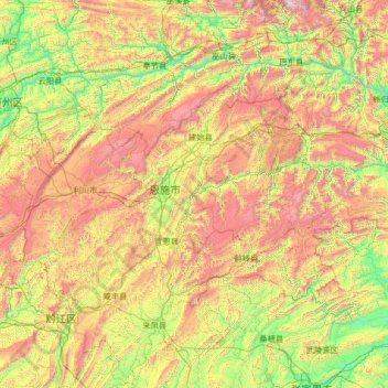
Name: Enshi Tujia and Miao Autonomous Prefecture topographic map, elevation, terrain.
Location: Enshi Tujia and Miao Autonomous Prefecture, Hubei, PRC (29.11703 108.36258 31.39857 110.63898)
Average elevation: 910 m
Minimum elevation: 60 m
Maximum elevation: 2,875 m
Other topographic maps
Click on a map to view its topography, its elevation and its terrain.
Shennongjia
PRC > Hubei > Shennongjia
Shennongjia, Shennongjia Forestry District, Hubei, PRC
Average elevation: 1,408 m