
Schmitten topographic map
Interactive map
Click on the map to display elevation.
About this map
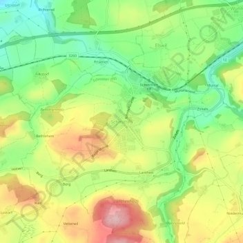
Name: Schmitten topographic map, elevation, terrain.
Location: Schmitten, Sensebezirk, Freiburg, 3185, Schweiz (46.83606 7.22740 46.87606 7.26740)
Average elevation: 646 m
Minimum elevation: 559 m
Maximum elevation: 751 m