
drainage topographic map
Interactive map
Click on the map to display elevation.
About this map
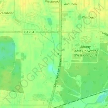
Name: drainage topographic map, elevation, terrain.
Average elevation: 64 m
Minimum elevation: 51 m
Maximum elevation: 72 m
Other topographic maps
Click on a map to view its topography, its elevation and its terrain.
Midway
United States of America > Georgia > Midway
Midway, Habersham County, Georgia, United States of America
Average elevation: 438 m
Clarkston
United States of America > Georgia > Clarkston
Clarkston, DeKalb County, Georgia, 30021, United States of America
Average elevation: 307 m
Nahunta
United States of America > Georgia > Nahunta
Nahunta, Brantley County, Georgia, 31553, United States of America
Average elevation: 19 m
Warner Robins
United States of America > Georgia > Warner Robins
Warner Robins, Houston County, Georgia, United States of America
Average elevation: 101 m
Saint Clair Estates
United States of America > Georgia > Saint Clair Estates
Saint Clair Estates, Glynn County, Georgia, 31522, United States of America
Average elevation: 4 m
Leveretts
United States of America > Georgia > Leveretts
Leveretts, Webster County, Georgia, 31777, United States of America
Average elevation: 143 m
Hillcrest
United States of America > Georgia > Hillcrest
Hillcrest, Oconee County, Georgia, 30677, United States of America
Average elevation: 231 m
Edge Hill
United States of America > Georgia > Edge Hill
Edge Hill, Glascock County, Georgia, United States of America
Average elevation: 136 m
Saint George
United States of America > Georgia > Saint George
Saint George, Georgia, United States of America
Average elevation: 21 m
Hickox
United States of America > Georgia > Hickox
Hickox, Brantley County, Georgia, United States of America
Average elevation: 18 m
Okefenokee National Wildlife Refuge
United States of America > Georgia
Okefenokee National Wildlife Refuge, Georgia, United States of America
Average elevation: 35 m
Folkston
United States of America > Georgia > Folkston
Folkston, Charlton County, Georgia, 31537, United States of America
Average elevation: 24 m
Charlton County
United States of America > Georgia
Charlton County, Georgia, United States of America
Average elevation: 27 m
Vine City
United States of America > Georgia > Atlanta > Vine City
Vine City, Atlanta, Fulton County, Georgia, 30313, United States of America
Average elevation: 301 m
Edmunston Creek
United States of America > Georgia
Edmunston Creek, Lumpkin County, Georgia, United States of America
Average elevation: 490 m