
Saint-Alexandre-d'Iberville topographic map
Interactive map
Click on the map to display elevation.
About this map
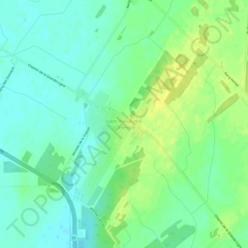
Name: Saint-Alexandre-d'Iberville topographic map, elevation, terrain.
Average elevation: 54 m
Minimum elevation: 45 m
Maximum elevation: 65 m
Other topographic maps
Click on a map to view its topography, its elevation and its terrain.
Pointe-McGinnis
Canada > Québec > Le Haut-Richelieu > Saint-Alexandre > Saint-Alexandre-d'Iberville
Pointe-McGinnis, Saint-Alexandre-d'Iberville, Saint-Alexandre, Le Haut-Richelieu, Montérégie, Québec, J0J 1S0, Canada
Average elevation: 52 m