
Kirby Bellars topographic map
Interactive map
Click on the map to display elevation.
About this map
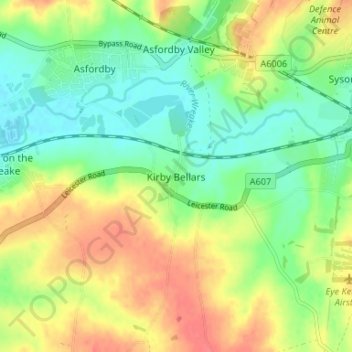
Name: Kirby Bellars topographic map, elevation, terrain.
Average elevation: 87 m
Minimum elevation: 63 m
Maximum elevation: 117 m
Other topographic maps
Click on a map to view its topography, its elevation and its terrain.
Bottesford
United Kingdom > England > Leicestershire > Melton
Bottesford, Melton, Leicestershire, England, United Kingdom
Average elevation: 39 m