
Sha Tin topographic map
Interactive map
Click on the map to display elevation.
About this map
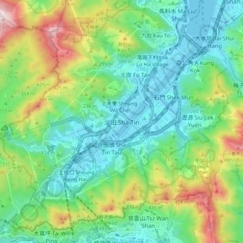
Name: Sha Tin topographic map, elevation, terrain.
Location: Sha Tin, Sha Tin District, New Territories, Hong Kong, China (22.34356 114.14998 22.42356 114.22998)
Average elevation: 198 m
Minimum elevation: -3 m
Maximum elevation: 664 m