
Thank you for supporting this site ❤️
Make a donation
Make a donation
Karama topographic map
Click on the map to display elevation.
Thank you for supporting this site ❤️
Make a donation
Make a donation
About this map
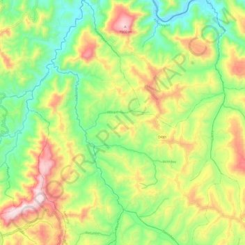
Name: Karama topographic map, elevation, terrain.
Location: Karama, Kamonyi, Southern Province, Rwanda (-1.98334 29.79695 -1.86288 29.88193)
Average elevation: 1,625 m
Minimum elevation: 1,367 m
Maximum elevation: 1,992 m
Thank you for supporting this site ❤️
Make a donation
Make a donation