
Howth topographic map
Interactive map
Click on the map to display elevation.
About this map
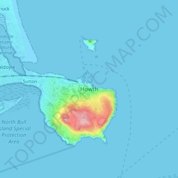
Name: Howth topographic map, elevation, terrain.
Location: Howth, Fingal, County Dublin, Leinster, D13 V2F9, Irland (53.34583 -6.10512 53.42583 -6.02512)
Average elevation: 8 m
Minimum elevation: -2 m
Maximum elevation: 160 m
Other topographic maps
Click on a map to view its topography, its elevation and its terrain.
Knockanteedan
Knockanteedan, Glassamucky, Bohernabreena DED 1986, South Dublin, County Dublin, Leinster, D24 T651, Irland
Average elevation: 243 m
Goatstown
Goatstown, Dún Laoghaire-Rathdown, County Dublin, Leinster, D14 WR83, Irland
Average elevation: 57 m