
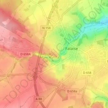
Mont Myrrha topographic map
Interactive map
Click on the map to display elevation.
About this map
Name: Mont Myrrha topographic map, elevation, terrain.
Average elevation: 162 m
Minimum elevation: 86 m
Maximum elevation: 207 m
Other topographic maps
Click on a map to view its topography, its elevation and its terrain.
Mont Myrrha
France > Normandie > Calvados > Falaise
Mont Myrrha, Falaise, Caen, Calvados, Normandie, France métropolitaine, 14700, France
Average elevation: 162 m