
Thank you for supporting this site ❤️
Make a donation
Make a donation
Alton Barnes topographic map
Click on the map to display elevation.
Thank you for supporting this site ❤️
Make a donation
Make a donation
About this map
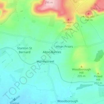
Name: Alton Barnes topographic map, elevation, terrain.
Location: Alton Barnes, Wiltshire, England, SN8 4LE, United Kingdom (51.33697 -1.87020 51.37697 -1.83020)
Average elevation: 154 m
Minimum elevation: 107 m
Maximum elevation: 295 m
Thank you for supporting this site ❤️
Make a donation
Make a donation
Other topographic maps
Click on a map to view its topography, its elevation and its terrain.