
Naginimora topographic map
Interactive map
Click on the map to display elevation.
About this map
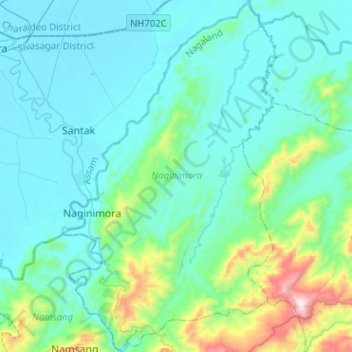
Name: Naginimora topographic map, elevation, terrain.
Location: Naginimora, Mon District, Nagaland, 798622, India (26.72047 94.78816 26.94771 94.94343)
Average elevation: 260 m
Minimum elevation: 91 m
Maximum elevation: 1,207 m