
Chãos topographic map
Interactive map
Click on the map to display elevation.
About this map
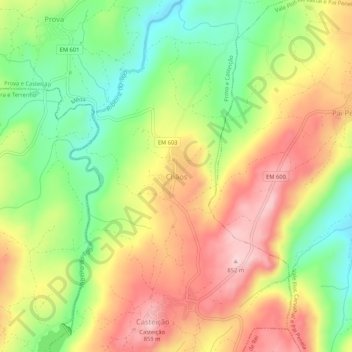
Name: Chãos topographic map, elevation, terrain.
Location: Chãos, Prova e Casteição, Mêda, Guarda, Portugal (40.87598 -7.34366 40.91598 -7.30366)
Average elevation: 725 m
Minimum elevation: 606 m
Maximum elevation: 848 m
Other topographic maps
Click on a map to view its topography, its elevation and its terrain.
Prova
Portugal > Guarda > Prova e Casteição
Prova, Prova e Casteição, Mêda, Guarda, Portugal
Average elevation: 730 m