
Balkanabat topographic map
Interactive map
Click on the map to display elevation.
About this map
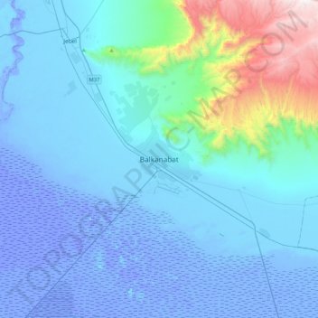
Name: Balkanabat topographic map, elevation, terrain.
Location: Balkanabat, Balkan Region, 75100, Turkmenistan (39.35163 54.19399 39.67163 54.51399)
Average elevation: 214 m
Minimum elevation: -28 m
Maximum elevation: 1,860 m