
Sussundenga topographic map
Interactive map
Click on the map to display elevation.
About this map
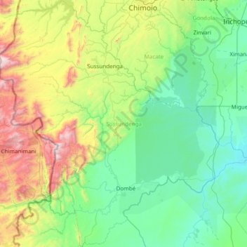
Name: Sussundenga topographic map, elevation, terrain.
Location: Sussundenga, Provinz Manica, Mosambik (-20.24488 32.77562 -19.11070 33.84967)
Average elevation: 501 m
Minimum elevation: 32 m
Maximum elevation: 2,382 m