
Thank you for supporting this site ❤️
Make a donation
Make a donation
Chandesara topographic map
Click on the map to display elevation.
Thank you for supporting this site ❤️
Make a donation
Make a donation
About this map
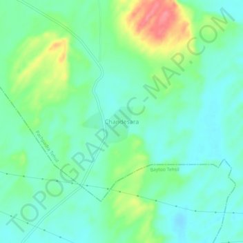
Name: Chandesara topographic map, elevation, terrain.
Location: Chandesara, Pachpadra Tehsil, Balotra, Rajasthan, India (25.83173 71.91028 25.87173 71.95028)
Average elevation: 121 m
Minimum elevation: 98 m
Maximum elevation: 176 m
Thank you for supporting this site ❤️
Make a donation
Make a donation