
Diana topographic map
Interactive map
Click on the map to display elevation.
About this map
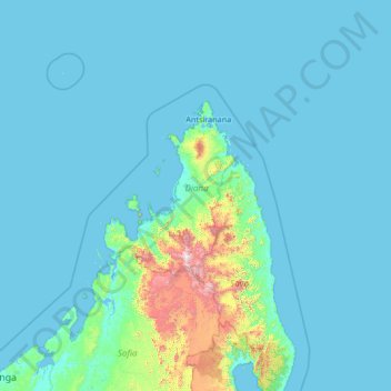
Name: Diana topographic map, elevation, terrain.
Location: Diana, Antsiranana Province, Madagascar (-15.80438 46.51114 -10.60438 51.71114)
Average elevation: 121 m
Minimum elevation: -1 m
Maximum elevation: 2,749 m
Other topographic maps
Click on a map to view its topography, its elevation and its terrain.