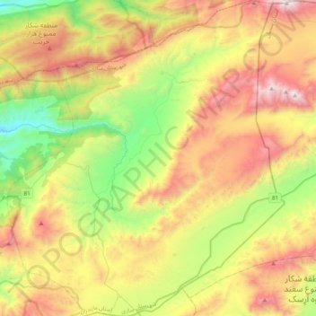
دهستان پشتکوه topographic map
Interactive map
Click on the map to display elevation.
About this map
Name: دهستان پشتکوه topographic map, elevation, terrain.
Average elevation: 1,984 m
Minimum elevation: 1,046 m
Maximum elevation: 3,241 m

Click on the map to display elevation.
Name: دهستان پشتکوه topographic map, elevation, terrain.
Average elevation: 1,984 m
Minimum elevation: 1,046 m
Maximum elevation: 3,241 m