
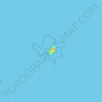
Île Rouzic topographic map
Interactive map
Click on the map to display elevation.
About this map
Name: Île Rouzic topographic map, elevation, terrain.
Average elevation: 0 m
Minimum elevation: 0 m
Maximum elevation: 40 m
Other topographic maps
Click on a map to view its topography, its elevation and its terrain.
Réserve naturelle des Sept-Îles
France > Bretagne > Perros-Guirec
Réserve naturelle des Sept-Îles, Chemin de Ronde Nord, Saint-Guirec, Perros-Guirec, Lannion, Côtes-d'Armor, Bretagne, France métropolitaine, 22700, France
Average elevation: 0 m
Île Tomé
France > Bretagne > Perros-Guirec
Île Tomé, Perros-Guirec, Lannion, Côtes-d'Armor, Bretagne, France métropolitaine, 22700, France
Average elevation: 1 m
Plage de Trestrignel
France > Bretagne > Perros-Guirec
Plage de Trestrignel, Boulevard de Trestrignel, Crec'h Guégan, Perros-Guirec, Lannion, Côtes-d'Armor, Bretagne, France métropolitaine, 22700, France
Average elevation: 8 m
Plage de Trestraou
France > Bretagne > Perros-Guirec
Plage de Trestraou, Boulevard Joseph Le Bihan, Crec'h Guégan, Perros-Guirec, Lannion, Côtes-d'Armor, Bretagne, France métropolitaine, 22700, France
Average elevation: 30 m