
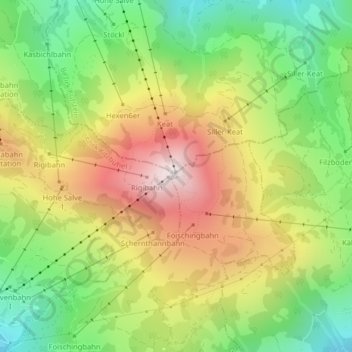
Hohe Salve topographic map
Interactive map
Click on the map to display elevation.
About this map
Name: Hohe Salve topographic map, elevation, terrain.
Average elevation: 1,360 m
Minimum elevation: 978 m
Maximum elevation: 1,824 m
Other topographic maps
Click on a map to view its topography, its elevation and its terrain.
Bichling
Oostenrijk > Tirol > Bezirk Kitzbühel > Gemeinde Westendorf > Westendorf
Bichling, Westendorf, Gemeinde Westendorf, Bezirk Kitzbühel, Tirol, 6363, Oostenrijk
Average elevation: 1,006 m
Brixentaler Ache
Oostenrijk > Tirol > Bezirk Kitzbühel > Gemeinde Westendorf
Brixentaler Ache, Gemeinde Westendorf, Bezirk Kitzbühel, Tirol, 6364, Oostenrijk
Average elevation: 1,014 m