
Cotswold topographic map
Interactive map
Click on the map to display elevation.
About this map
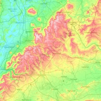
Name: Cotswold topographic map, elevation, terrain.
Average elevation: 118 m
Minimum elevation: 6 m
Maximum elevation: 328 m
Other topographic maps
Click on a map to view its topography, its elevation and its terrain.
Thames Head
Verenigd Koninkrijk > Engeland > Cotswold
Thames Head, Cotswold, Gloucestershire, Zuidwest-Engeland, Engeland, GL7 6NZ, Verenigd Koninkrijk
Average elevation: 117 m