
Biery topographic map
Interactive map
Click on the map to display elevation.
About this map
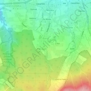
Name: Biery topographic map, elevation, terrain.
Average elevation: 374 m
Minimum elevation: 323 m
Maximum elevation: 459 m
Other topographic maps
Click on a map to view its topography, its elevation and its terrain.
Wilkowice
Polen > Woiwodschap Silezië > powiat bielski
Wilkowice, gmina Wilkowice, powiat bielski, Woiwodschap Silezië, 43-365, Polen
Average elevation: 493 m