
Thank you for supporting this site ❤️
Make a donation
Make a donation
Empire Prairie topographic map
Click on the map to display elevation.
Thank you for supporting this site ❤️
Make a donation
Make a donation
About this map
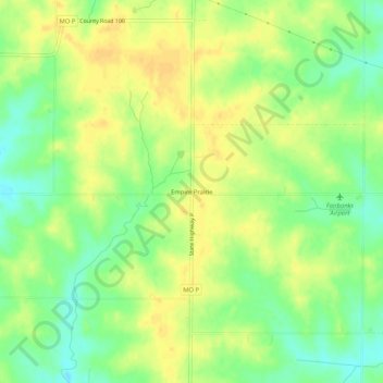
Name: Empire Prairie topographic map, elevation, terrain.
Location: Empire Prairie, Andrew County, Missouri, United States (40.06305 -94.65913 40.10305 -94.61913)
Average elevation: 328 m
Minimum elevation: 312 m
Maximum elevation: 340 m
Thank you for supporting this site ❤️
Make a donation
Make a donation
Other topographic maps
Click on a map to view its topography, its elevation and its terrain.
Thank you for supporting this site ❤️
Make a donation
Make a donation
Thank you for supporting this site ❤️
Make a donation
Make a donation