
Thank you for supporting this site ❤️
Make a donation
Make a donation
Tuban topographic map
Click on the map to display elevation.
Thank you for supporting this site ❤️
Make a donation
Make a donation
About this map
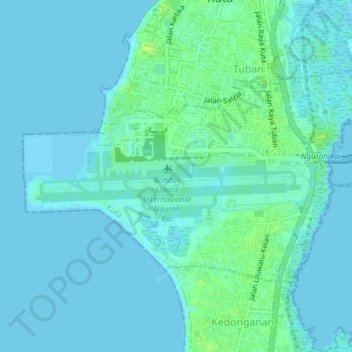
Name: Tuban topographic map, elevation, terrain.
Location: Tuban, Kuta, Badung, Bali, Lesser Sunda Islands, Indonesia (-8.75789 115.15195 -8.73539 115.18952)
Average elevation: 3 m
Minimum elevation: -1 m
Maximum elevation: 12 m
Thank you for supporting this site ❤️
Make a donation
Make a donation