
Overdinkel topographic map
Interactive map
Click on the map to display elevation.
About this map
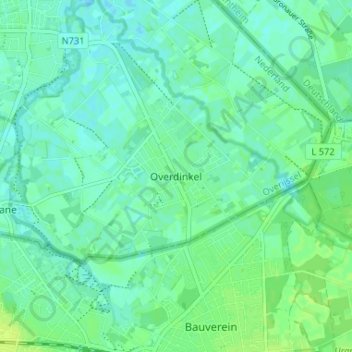
Name: Overdinkel topographic map, elevation, terrain.
Location: Overdinkel, Overijssel, Niederlande, 7586, Niederlande (52.21506 7.01683 52.25506 7.05683)
Average elevation: 38 m
Minimum elevation: 33 m
Maximum elevation: 46 m