
Zhoukou topographic map
Interactive map
Click on the map to display elevation.
About this map
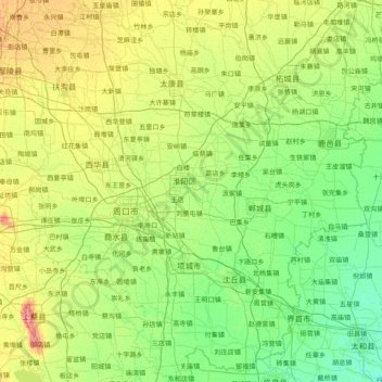
Name: Zhoukou topographic map, elevation, terrain.
Location: Zhoukou, Henan, China (33.05112 114.08416 34.33845 115.65412)
Average elevation: 48 m
Minimum elevation: 31 m
Maximum elevation: 100 m
Other topographic maps
Click on a map to view its topography, its elevation and its terrain.