
Thank you for supporting this site ❤️
Make a donation
Make a donation
Escherhof topographic map
Click on the map to display elevation.
Thank you for supporting this site ❤️
Make a donation
Make a donation
About this map
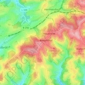
Name: Escherhof topographic map, elevation, terrain.
Average elevation: 325 m
Minimum elevation: 256 m
Maximum elevation: 396 m
Thank you for supporting this site ❤️
Make a donation
Make a donation
Other topographic maps
Click on a map to view its topography, its elevation and its terrain.
Hermesdorf
Deutschland > Nordrhein-Westfalen > Oberbergischer Kreis > Waldbröl > Wilkenroth > Thierseifen
Average elevation: 299 m
51545
Deutschland > Nordrhein-Westfalen > Oberbergischer Kreis > Waldbröl > Romberg
Average elevation: 305 m