
Thank you for supporting this site ❤️
Make a donation
Make a donation
Hopewell topographic map
Click on the map to display elevation.
Thank you for supporting this site ❤️
Make a donation
Make a donation
About this map
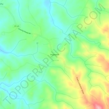
Name: Hopewell topographic map, elevation, terrain.
Location: Hopewell, Cleburne County, Alabama, United States (33.61205 -85.40273 33.65205 -85.36273)
Average elevation: 327 m
Minimum elevation: 281 m
Maximum elevation: 415 m
Thank you for supporting this site ❤️
Make a donation
Make a donation
Other topographic maps
Click on a map to view its topography, its elevation and its terrain.