
Stranig topographic map
Interactive map
Click on the map to display elevation.
About this map
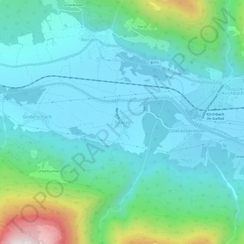
Name: Stranig topographic map, elevation, terrain.
Location: Stranig, Kirchbach, Bezirk Hermagor, Kärnten, 9633, Österreich (46.61576 13.14053 46.65576 13.18053)
Average elevation: 797 m
Minimum elevation: 611 m
Maximum elevation: 1,589 m
Other topographic maps
Click on a map to view its topography, its elevation and its terrain.
Oberbuchach
Österreich > Kärnten > Bezirk Hermagor > Kirchbach
Oberbuchach, Kirchbach, Bezirk Hermagor, Kärnten, 9634, Österreich
Average elevation: 1,037 m
Kötschach-Mauthen
Österreich > Kärnten > Bezirk Hermagor
Kötschach-Mauthen, Bezirk Hermagor, Kärnten, 9640, Österreich
Average elevation: 1,369 m