
Thank you for supporting this site ❤️
Make a donation
Make a donation
Blessington topographic map
Click on the map to display elevation.
Thank you for supporting this site ❤️
Make a donation
Make a donation
About this map
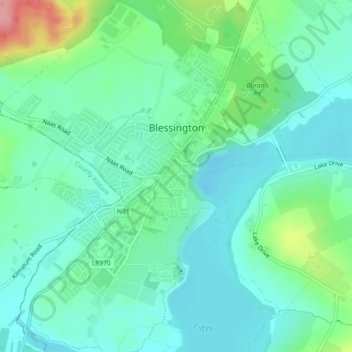
Name: Blessington topographic map, elevation, terrain.
Location: Blessington, County Wicklow, Leinster, Ireland (53.15869 -6.55382 53.17903 -6.52136)
Average elevation: 204 m
Minimum elevation: 177 m
Maximum elevation: 285 m
Thank you for supporting this site ❤️
Make a donation
Make a donation
Other topographic maps
Click on a map to view its topography, its elevation and its terrain.