
Absberg topographic map
Interactive map
Click on the map to display elevation.
About this map
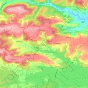
Name: Absberg topographic map, elevation, terrain.
Average elevation: 443 m
Minimum elevation: 360 m
Maximum elevation: 521 m
Other topographic maps
Click on a map to view its topography, its elevation and its terrain.
Meinheim
Deutschland > Bayern > Landkreis Weißenburg-Gunzenhausen
Meinheim, Altmühltal (VGem), Landkreis Weißenburg-Gunzenhausen, Bayern, 91802, Deutschland
Average elevation: 495 m