
Thank you for supporting this site ❤️
Make a donation
Make a donation
Stow topographic map
Click on the map to display elevation.
Thank you for supporting this site ❤️
Make a donation
Make a donation
About this map
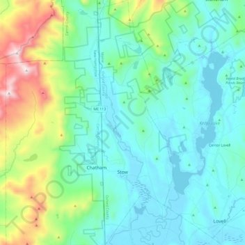
Name: Stow topographic map, elevation, terrain.
Location: Stow, Oxford County, Maine, 04037, United States (44.11059 -71.00960 44.27937 -70.93669)
Average elevation: 308 m
Minimum elevation: 109 m
Maximum elevation: 1,080 m
Thank you for supporting this site ❤️
Make a donation
Make a donation