
Thank you for supporting this site ❤️
Make a donation
Make a donation
Fergus topographic map
Click on the map to display elevation.
Thank you for supporting this site ❤️
Make a donation
Make a donation
About this map
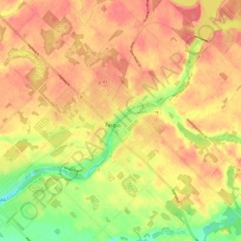
Name: Fergus topographic map, elevation, terrain.
Average elevation: 415 m
Minimum elevation: 373 m
Maximum elevation: 439 m
Thank you for supporting this site ❤️
Make a donation
Make a donation
Other topographic maps
Click on a map to view its topography, its elevation and its terrain.
Belwood Lake Boat Launch
Canada > Ontario > Wellington County > Centre Wellington
Average elevation: 443 m