
Thank you for supporting this site ❤️
Make a donation
Make a donation
Liusha topographic map
Click on the map to display elevation.
Thank you for supporting this site ❤️
Make a donation
Make a donation
About this map
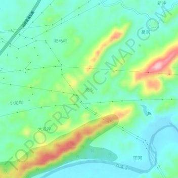
Name: Liusha topographic map, elevation, terrain.
Location: Liusha, Guilin, Guangxi, China (24.53102 110.43503 24.57102 110.47503)
Average elevation: 181 m
Minimum elevation: 121 m
Maximum elevation: 333 m
Thank you for supporting this site ❤️
Make a donation
Make a donation
Other topographic maps
Click on a map to view its topography, its elevation and its terrain.
Huixian Karst National Wetland Park, Guilin, Guangxi
Average elevation: 156 m
Thank you for supporting this site ❤️
Make a donation
Make a donation