
Thank you for supporting this site ❤️
Make a donation
Make a donation
Kühtai topographic map
Click on the map to display elevation.
Thank you for supporting this site ❤️
Make a donation
Make a donation
About this map
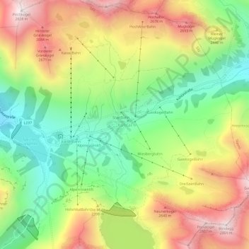
Name: Kühtai topographic map, elevation, terrain.
Location: Kühtai, Gemeinde Silz, Bezirk Imst, Tyrol, 6183, Austria (47.19362 11.00340 47.23362 11.04340)
Average elevation: 2,265 m
Minimum elevation: 1,826 m
Maximum elevation: 2,807 m
Thank you for supporting this site ❤️
Make a donation
Make a donation