
Clifton topographic map
Interactive map
Click on the map to display elevation.
About this map
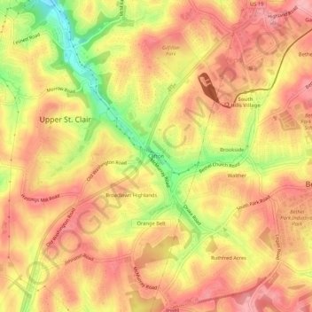
Name: Clifton topographic map, elevation, terrain.
Average elevation: 343 m
Minimum elevation: 266 m
Maximum elevation: 384 m
Other topographic maps
Click on a map to view its topography, its elevation and its terrain.
Beadling
United States > Pennsylvania > Allegheny County > Upper St. Clair
Beadling, Upper St. Clair, Allegheny County, Pennsylvania, 15243, United States
Average elevation: 326 m
Upper St. Clair
United States > Pennsylvania > Allegheny County > Upper St. Clair
Upper St. Clair, Allegheny County, Pennsylvania, 15241, United States
Average elevation: 323 m