
Finlayson topographic map
Interactive map
Click on the map to display elevation.
About this map
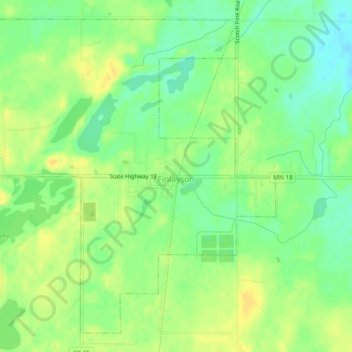
Name: Finlayson topographic map, elevation, terrain.
Location: Finlayson, Pine County, Minnesota, United States (46.18735 -92.94971 46.21639 -92.90273)
Average elevation: 339 m
Minimum elevation: 325 m
Maximum elevation: 350 m
Other topographic maps
Click on a map to view its topography, its elevation and its terrain.
Sandstone
United States > Minnesota > Pine County
Sandstone, Pine County, Minnesota, United States
Average elevation: 332 m
Big Pine Lake
United States > Minnesota > Pine County
Big Pine Lake, Pine County, Minnesota, United States
Average elevation: 339 m
Greely
United States > Minnesota > Pine County
Greely, Pine County, Minnesota, United States
Average elevation: 292 m
Willow River
United States > Minnesota > Pine County
Willow River, Pine County, Minnesota, United States
Average elevation: 319 m