
Thank you for supporting this site ❤️
Make a donation
Make a donation
Villevieille topographic map
Click on the map to display elevation.
Thank you for supporting this site ❤️
Make a donation
Make a donation
About this map
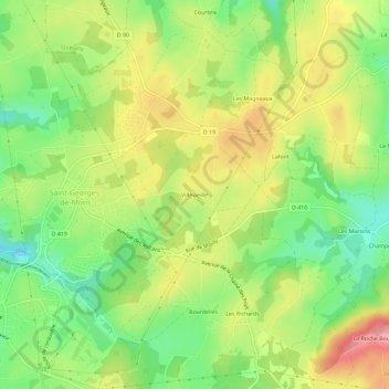
Name: Villevieille topographic map, elevation, terrain.
Average elevation: 734 m
Minimum elevation: 673 m
Maximum elevation: 805 m
Thank you for supporting this site ❤️
Make a donation
Make a donation
Other topographic maps
Click on a map to view its topography, its elevation and its terrain.
63780
France > Auvergne-Rhône-Alpes > Puy-de-Dôme > Saint-Georges-de-Mons > Courteix
Average elevation: 681 m