
Thank you for supporting this site ❤️
Make a donation
Make a donation
Al Rashidiya topographic map
Click on the map to display elevation.
Thank you for supporting this site ❤️
Make a donation
Make a donation
About this map
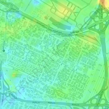
Name: Al Rashidiya topographic map, elevation, terrain.
Location: Al Rashidiya, Dubai, United Arab Emirates (25.21232 55.37638 25.23718 55.40510)
Average elevation: 15 m
Minimum elevation: 2 m
Maximum elevation: 34 m
Thank you for supporting this site ❤️
Make a donation
Make a donation
Other topographic maps
Click on a map to view its topography, its elevation and its terrain.