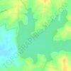
Idalgashinna topographic map
Click on the map to display elevation.
Idalgashinna
Idalgashinna (Sinhala: ඉදල්ගස්හින්න, Tamil: இதல்கஸ்ஹின்ன) is a small village in the Badulla District, Uva Province, Sri Lanka. Situated at an elevation of about 1,615 metres (5,299 ft) above sea level, it is located in the Haputale-Namunukula mountain range. The area is home to the Idalgashinna Estate, with the closest large town being Haputale, about 9km south on the railway. Between the two locales lies the Thangamale Bird Sanctuary. Education in the area comes under the purview of the Welimada Divisional Secretariat, which administers the Idalgashinna Tamil Vidyalaya (Idalgashinna Tamil College), Beauvais Tamil Vidyalaya and the Ellethota Vidyalaya.
About this map

Name: Idalgashinna topographic map, elevation, terrain.
Location: Idalgashinna, Badulla District, Uva Province, Sri Lanka (6.76190 80.87483 6.80190 80.91483)
Average elevation: 1,383 m
Minimum elevation: 869 m
Maximum elevation: 1,962 m
Other topographic maps
Click on a map to view its topography, its elevation and its terrain.


Yala National Park
The Yala area is mostly composed of metamorphic rock belonging to the Precambrian era and classified into two series, Vijayan series and Highland series. Reddish brown soil and low humic grey soil are prominent among six soil types. Yala is situated in the lowest peneplain of Sri Lanka, which extends from…
Average elevation: 65 m