
Astegg topographic map
Interactive map
Click on the map to display elevation.
About this map
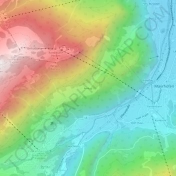
Name: Astegg topographic map, elevation, terrain.
Location: Astegg, Finkenberg, Bezirk Schwaz, Tirol, 6292, Oostenrijk (47.14676 11.81836 47.18676 11.85836)
Average elevation: 1,130 m
Minimum elevation: 599 m
Maximum elevation: 2,058 m