
Thank you for supporting this site ❤️
Make a donation
Make a donation
Niederndorf topographic map
Click on the map to display elevation.
Thank you for supporting this site ❤️
Make a donation
Make a donation
About this map
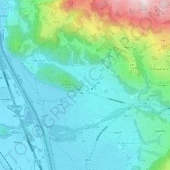
Name: Niederndorf topographic map, elevation, terrain.
Location: Niederndorf, Bezirk Kufstein, 6342, Austria (47.63846 12.18685 47.66531 12.24620)
Average elevation: 583 m
Minimum elevation: 459 m
Maximum elevation: 1,012 m
Thank you for supporting this site ❤️
Make a donation
Make a donation
Other topographic maps
Click on a map to view its topography, its elevation and its terrain.
Nassfeldpass / Passo di Pramollo
Austria > Carinthia > Bezirk Hermagor > Hermagor-Pressegger See > Sonnenalpe Naßfeld
Average elevation: 1,572 m
Thank you for supporting this site ❤️
Make a donation
Make a donation
Thank you for supporting this site ❤️
Make a donation
Make a donation
Ladings
Austria > Lower Austria > Bezirk Krems > Gemeinde Lichtenau im Waldviertel
Average elevation: 665 m
Thank you for supporting this site ❤️
Make a donation
Make a donation