
Murole topographic map
Interactive map
Click on the map to display elevation.
About this map
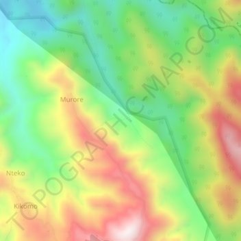
Name: Murole topographic map, elevation, terrain.
Location: Murole, Cyanika, Kisoro, Western Region, Ouganda (-1.07670 29.60442 -1.03670 29.64442)
Average elevation: 1,736 m
Minimum elevation: 1,410 m
Maximum elevation: 2,157 m