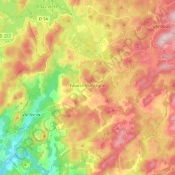
Faux-la-Montagne topographic map
Interactive map
Click on the map to display elevation.
About this map
Name: Faux-la-Montagne topographic map, elevation, terrain.
Average elevation: 702 m
Minimum elevation: 515 m
Maximum elevation: 874 m

Click on the map to display elevation.
Name: Faux-la-Montagne topographic map, elevation, terrain.
Average elevation: 702 m
Minimum elevation: 515 m
Maximum elevation: 874 m