
Lac Volta topographic map
Interactive map
Click on the map to display elevation.
About this map
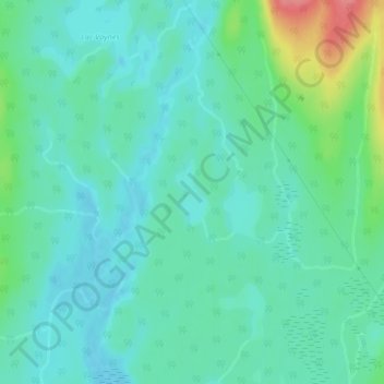
Name: Lac Volta topographic map, elevation, terrain.
Average elevation: 427 m
Minimum elevation: 408 m
Maximum elevation: 487 m
Other topographic maps
Click on a map to view its topography, its elevation and its terrain.
Lac Coincé
Canada > Québec > Lac-Ashuapmushuan
Lac Coincé, Lac-Ashuapmushuan, Le Domaine-du-Roy, Saguenay–Lac-Saint-Jean, Québec, Canada
Average elevation: 373 m
Lac Fictif
Canada > Québec > Lac-Ashuapmushuan
Lac Fictif, Lac-Ashuapmushuan, Le Domaine-du-Roy, Saguenay - Lac-Saint-Jean, Québec, Canada
Average elevation: 574 m