
Umatilla County topographic map
Interactive map
Click on the map to display elevation.
About this map
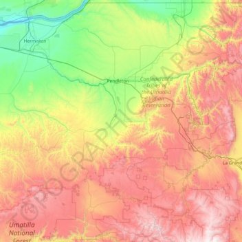
Name: Umatilla County topographic map, elevation, terrain.
Location: Umatilla County, Oregon, United States of America (44.99589 -119.43549 46.00107 -117.97292)
Average elevation: 907 m
Minimum elevation: 80 m
Maximum elevation: 2,200 m
Other topographic maps
Click on a map to view its topography, its elevation and its terrain.
Roseburg
United States of America > Oregon > Roseburg
Roseburg, Douglas County, Oregon, United States of America
Average elevation: 239 m
Clackamas County
United States of America > Oregon
Clackamas County, Oregon, United States of America
Average elevation: 660 m
Hillsboro
United States of America > Oregon > Hillsboro
Hillsboro, Washington County, Oregon, United States of America
Average elevation: 53 m
Tillamook County
United States of America > Oregon
Tillamook County, Oregon, United States of America
Average elevation: 236 m