
Aizwal topographic map
Interactive map
Click on the map to display elevation.
About this map
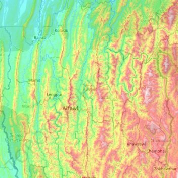
Name: Aizwal topographic map, elevation, terrain.
Location: Aizwal, Mizoram, India (23.30854 92.62402 24.41308 93.04077)
Average elevation: 608 m
Minimum elevation: 27 m
Maximum elevation: 2,105 m
Other topographic maps
Click on a map to view its topography, its elevation and its terrain.