
Grivegnée topographic map
Interactive map
Click on the map to display elevation.
About this map
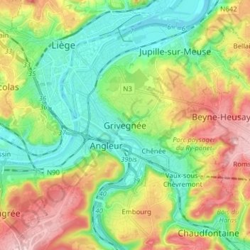
Name: Grivegnée topographic map, elevation, terrain.
Location: Grivegnée, Lüttich, Wallonien, 4000, Belgien (50.57930 5.56476 50.65930 5.64476)
Average elevation: 130 m
Minimum elevation: 54 m
Maximum elevation: 258 m